


ORDNANCE SURVEY IRL
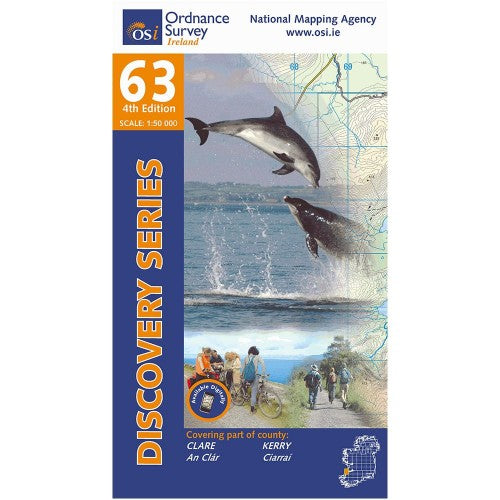
OSI Discovery Laminated Waterproof Map 63 (Part of Clare & Kerry)(1:50,000)
OSI Discovery Laminated Waterproof Map 63 (Part of Clare & Kerry)(1:50,000)
Landers Tralee
Landers Outdoor World
Mile Height
Tralee
Kerry
V92 PP9C
Ireland
Ordnance Survey Map Sheet 63 Laminated | Part of Clare and Kerry
Map includes:
- Ballybunion | Baile an Bhuinneánaigh
- Ballyduff | An Baile Dubh
- Ballylongford | Béal Átha Longfoirt
- Carrigaholt | Carraig an Chabhaltaigh
- Carrig Island | Oileán na Carraige
- Causeway | An Tóchar
- Doonbeg | An Dún Beag
- Doonbeg Loop Walk
- Kerry Head | Ceann Chiarraí
- Kilkee | Cill Chaoi
- Kilrush | Cill Rois
- Knockanore Mountain | Cnoc an Óir
- Listowel | Lios Tuathail (part of)
- Loop Head | Ceann Léime
- North Kerry Way: Tiduff - Glenlea
- Shannon Estuary
- Poolnasherry Bay | Poll na nOisrí
- Scattery Island | Inis Cathaigh
- Tullaher Loop Walk
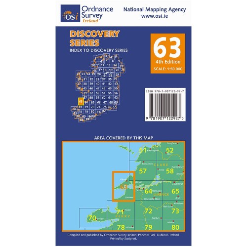
Discovery maps are produced at a scale of 1:50,000 (or 2cm on paper equals 1 kilometer on the ground). Each Discovery Sheet covers an area of 40km x 30km surface area (with the exception of several portrait-format sheets, which are 42km x 32km). There are 93 sheets in the series; 75 are produced by Ordnance Survey Ireland, and 18 by Ordnance Survey Northern Ireland. The maps produced by Ordnance Survey Northern Ireland are called the Discoverer Series.
This is a comprehensive series of feature-rich maps which show detailed landscape information, like rivers, lakes, contours and many townland names. The Discovery Series is designed primarily for tourist and leisure activities; these maps are the preferred choice for hill walkers and those in pursuit of the great outdoors. It is also an ideal reference for location-focused business use, in pocket-friendly folded form or as a wall-mounted reference.
Check out our waterproof map cases and dry bags to keep your gear safe and dry during the lovely Irish rain!
OSI Discovery Map 63 Laminated Part of Clare & Kerry 1:50,000 OSI63LF
Choose options