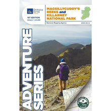
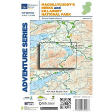
Macgillycuddy Reeks & Killarney National Park. map -The Adventure Series is printed on Water Resistant Paper (not laminated).
The Adventure Series is an activity oriented map which shows detailed landscape information. It provides detailed mapping in specific locations for the outdoor enthusiast such as mountaineers, hill walkers, cyclists and other users of the Irish countryside.
Includes:
- Killarney Town
- Killarney National Park
- MacGillycuddy’s Reeks
- Roads - N22, N71, N72, R568 and more.
- A detailed enlarged area showing Carrauntoohil, the highest peak in Ireland, and the surrounding area at 1:12,500.
- Killarney and Beaufort are marked.
- Peaks - Carrauntoohil, Beenkeragh, Caher, Knocknapeasta, The Bones Peak and the Big Gun
- Lough Leane, Muckross Lake, Lough Caragh, Lough Acoose , Lough Fadda, Lough Beg and more
- The River Flesk, River Laune and River Gearhameen and more
- The Ring of Kerry
- The Gap of Dunloe
- Moll’s Gap
- Walks and loops - The Kerry Way, National Park Loops, Hag’s Glen Loop, the Ring of Kerry Cycle Route and more
This is a very scenic area of Kerry and ever popular with visitors throughout the year whether they are looking for relaxation or an activity based holiday. Viewpoints are marked throughout the map.
Outdoor mountain pursuits are among the main tourist activities in the area. Mountain climbing is an important tourist activity in the MacGillycuddy’s Reeks.
Details:
- Language: English
- Scale: 1:25,000
- Orientation: Landscape
- DPI: 600
- Edition: 1
- Year: 2014
Check out our waterproof map cases and dry bags to keep your gear safe and dry during the lovely Irish rain!
OSI Adventure Series map: MacGillycuddy’s Reeks & Killarney National Park 1:25,000 OSIKNPREEKS


