


HARVEY
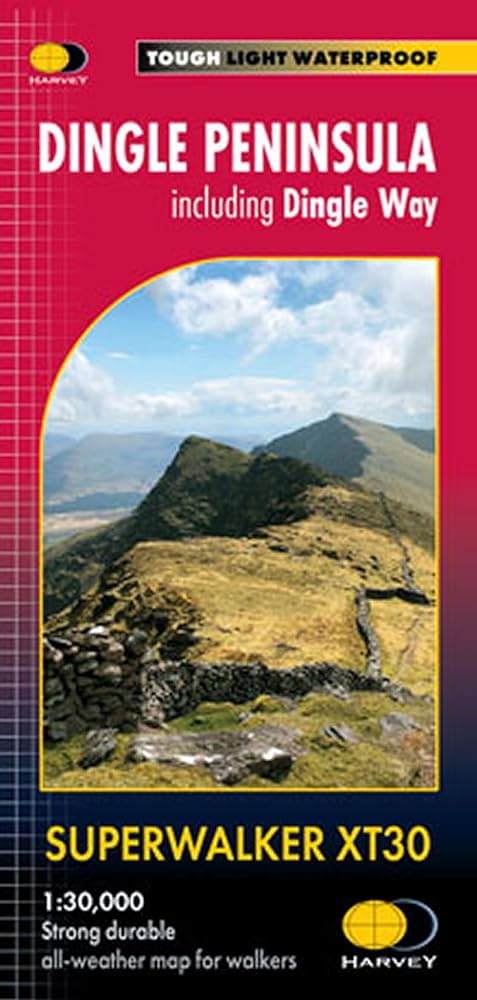
Harvey Dingle Peninsula (including Dingle Way) Superwalker XT30 Map (1:30,000)
Waterproof
Trail
Hiking
Quantity:
Pickup available at Landers Tralee
Usually ready in 1 hour
Harvey Dingle Peninsula (including Dingle Way) Superwalker XT30 Map (1:30,000)
Landers Tralee
Pickup available, usually ready in 1 hour
Landers Outdoor World
Mile Height
Tralee
Kerry
V92 PP9C
Ireland
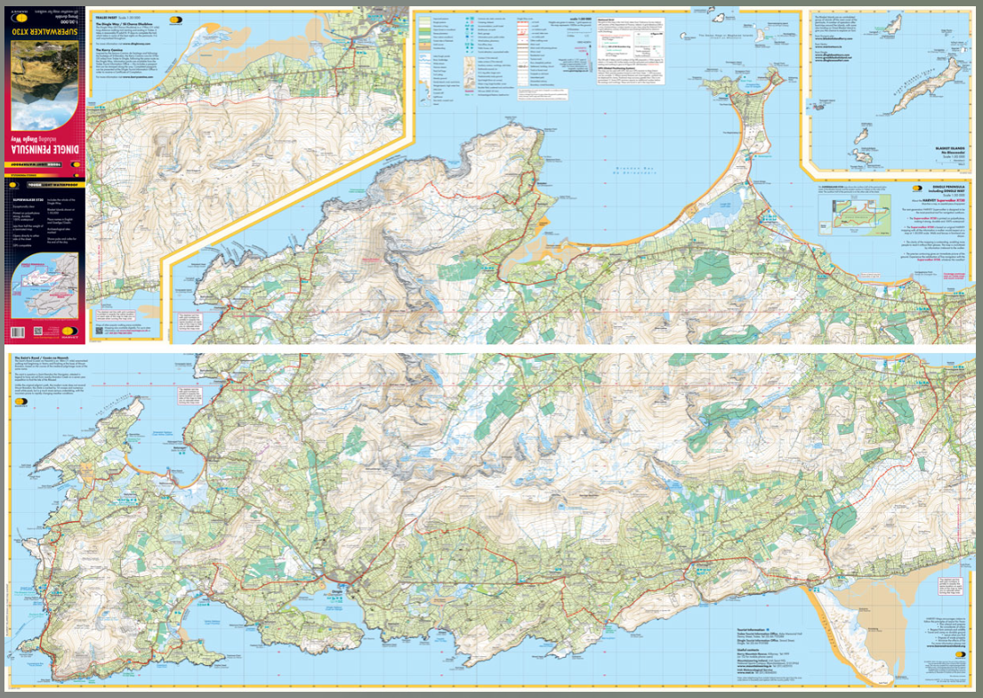
The whole of the Dingle Peninsula on one lightweight, waterproof map at the popular 1:30,000 scale.
Includes Mount Brandon and the entire Brandon Group of mountains in the west of the Peninsula. To the east, the Slieve Mish mountains are also shown.
The map also shows the Dingle Way - a 179km long distance walking route around the edge of the Peninsula that starts and finishes in Tralee. The route is highlighted in red.
The Blasket Islands are also shown at 1:50,000 scale. Popular for day trips, these uninhabited islands are the most westerly point of Europe.
Placenames in English and Gaeilge / Gaelic. Archaeological sites and walls and fences in farmland are clearly marked.
- Tough, light, durable and 100% waterproof
- Genuine, original, HARVEY mapping
- Opens directly to either side of the sheet
- Easy to re-fold
Check out our waterproof map cases and dry bags to keep your gear safe and dry during the lovely Irish rain!
HDINGLEPEN Harvey Dingle Peninsula (including Dingle Way) Superwalker XT30 Map (1:30,000)
Choose options
Quantity: