


EASTWEST MAPPING
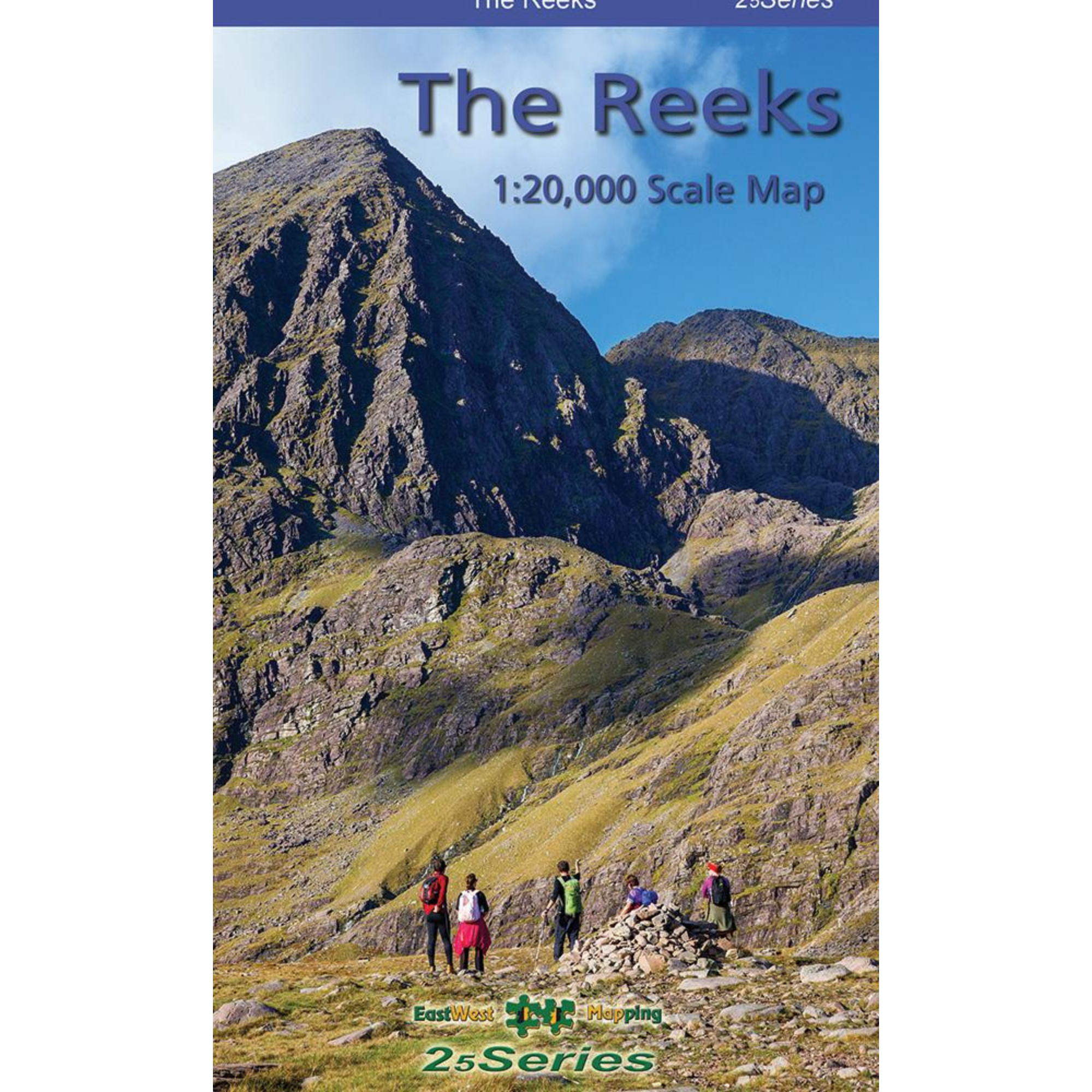
EastWest Mapping The Reeks Map (1:20,000)
EastWest Mapping The Reeks Map (1:20,000)
Landers Tralee
Landers Outdoor World
Mile Height
Tralee
Kerry
V92 PP9C
Ireland
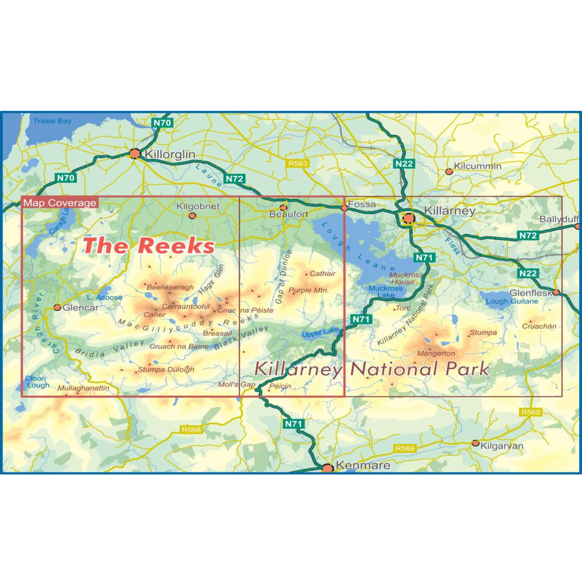
Definitive detailed map at 1:20,000 scale covering the main part of the MacGillycuddy Reeks from Caragh Lake to Lough Leane. Includes Carrauntoohil, the highest mountain in Ireland and all adjacent peaks.
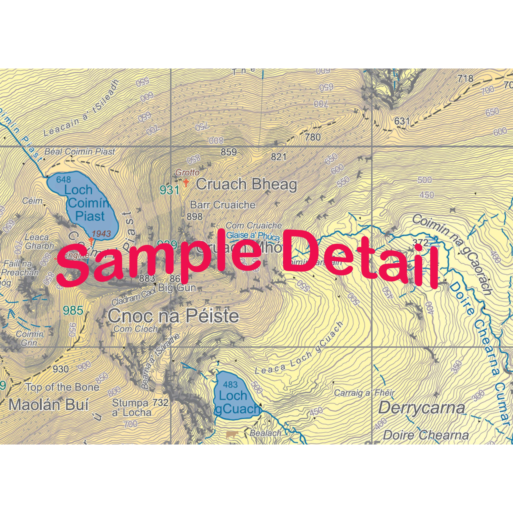
Produced to EastWest Mapping's 25Series standard, this general topographic map has a 5 metre contour interval for fine navigation. Signposted walking trails are depicted. Detailed topographic map with many place names and heritage sites.
Printed on good quality Progeo 90gsm map paper. The map sheet measures 1125mm x 820mm, covering 350sq kilometres and is folded down to 125mm x 205mm.
Details:
- This is the standard folded paper version
- Weight: 100g
- Dimensions: 20 × 12.5 × .5 cm
- Published 2022
EastWest Mapping The Reeks 1:20,000 Scale Map EWREEKS
General Care instructions:
For proper care and maintenance, always refer to the manufacturer’s instructions included with your product. If you cannot locate these instructions, please consult the manufacturer's website or contact them directly before cleaning or use.
Choose options